

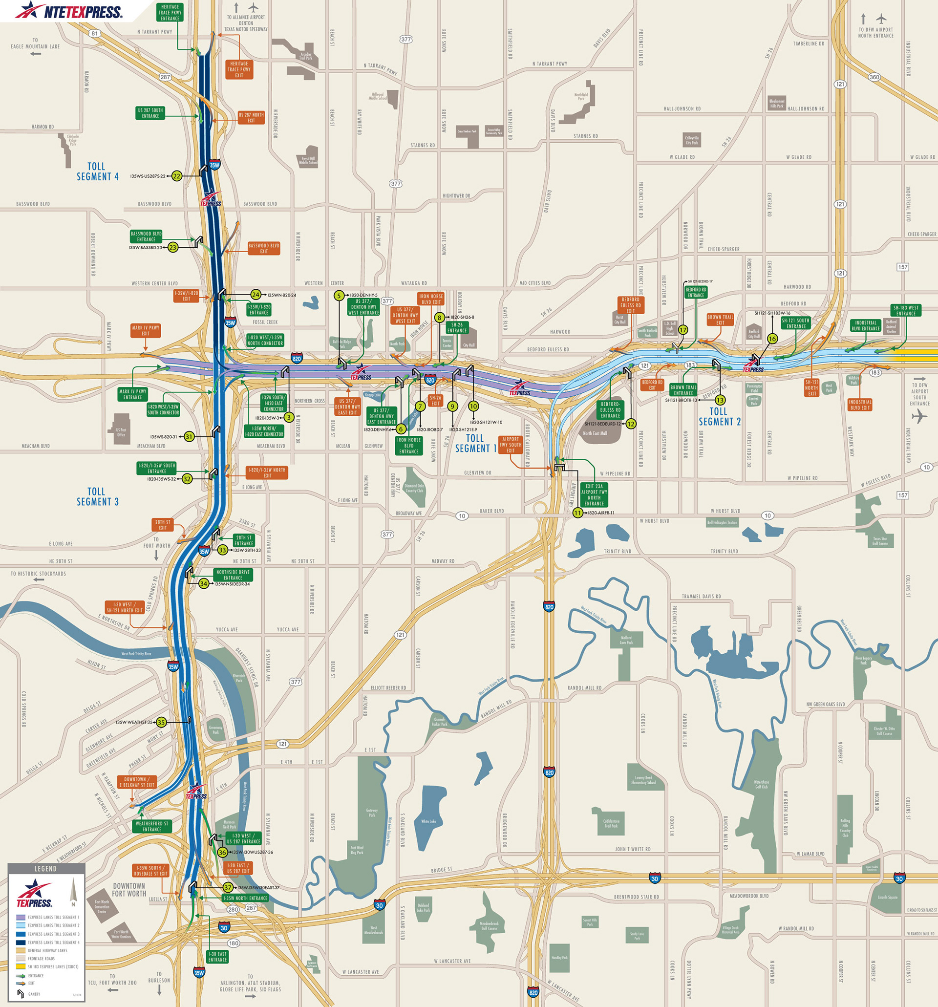
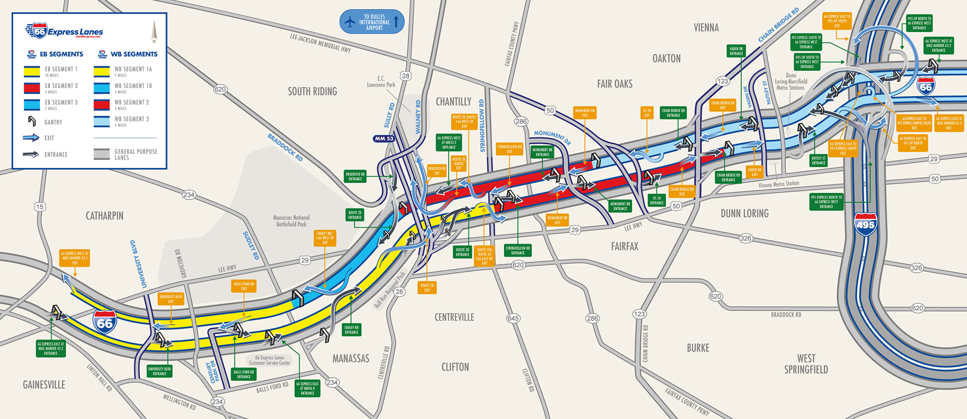
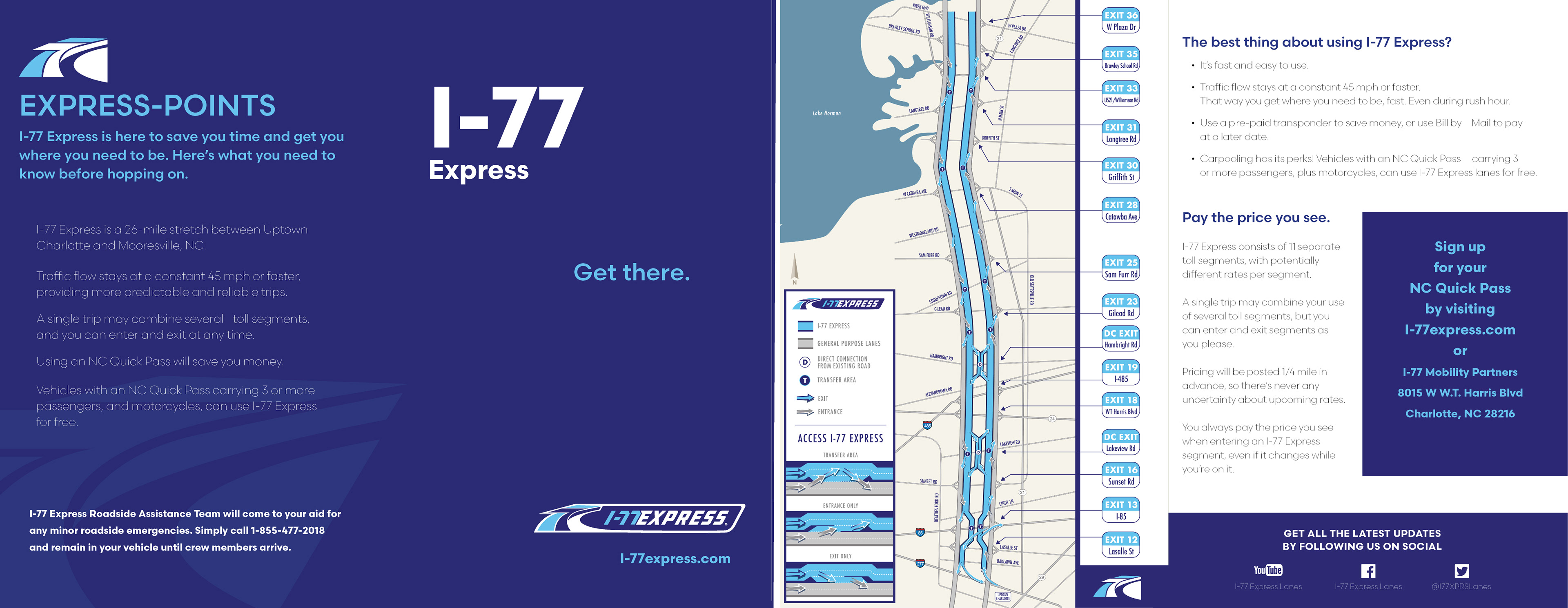
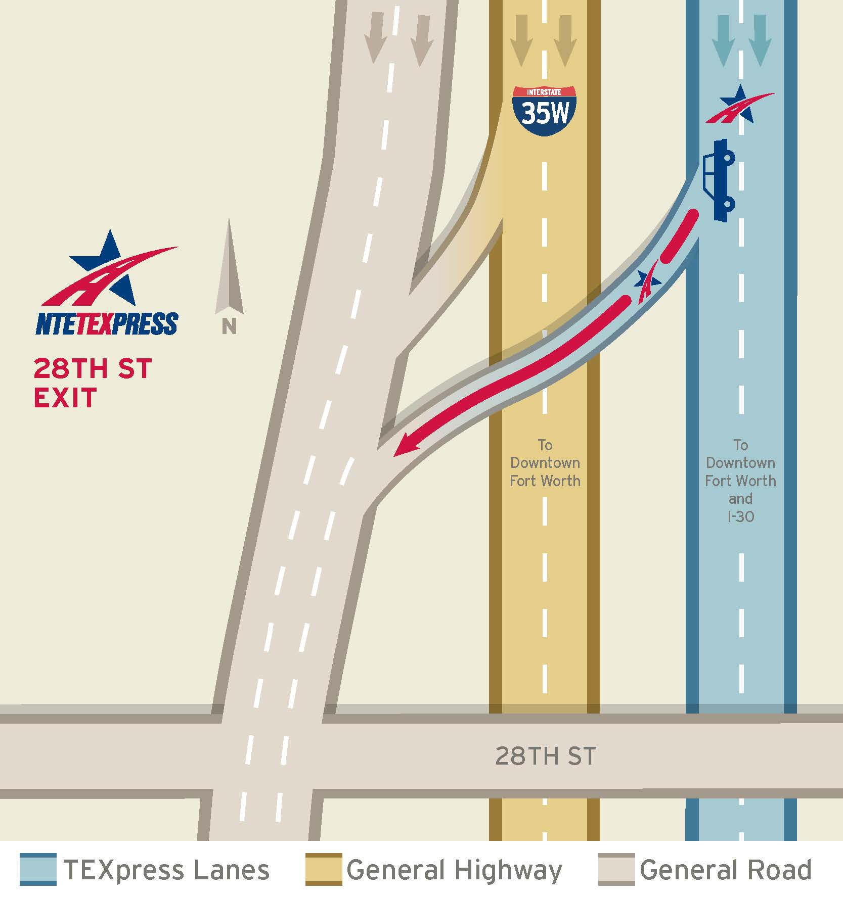
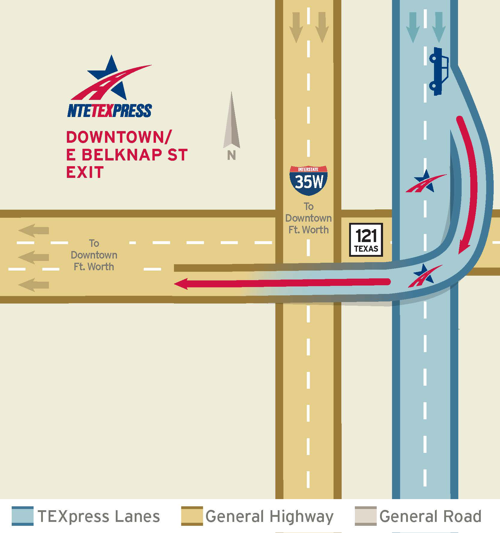
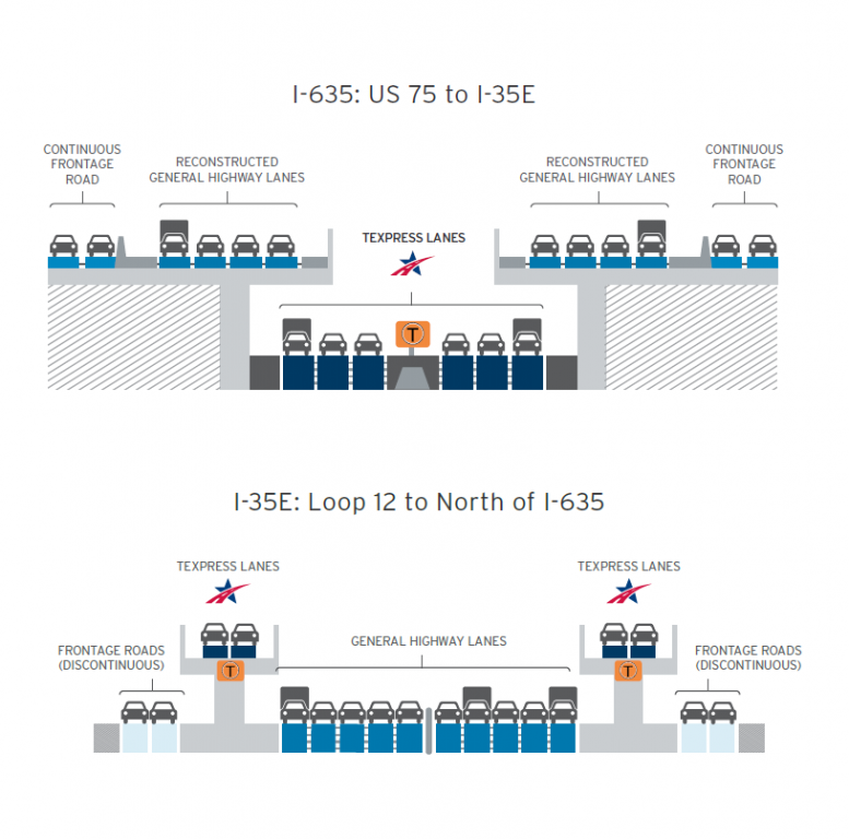
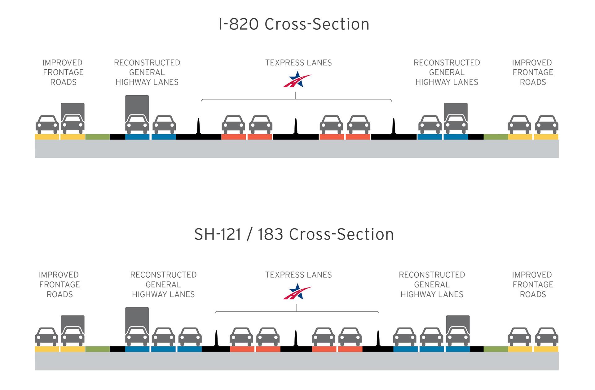

Over the past decade, I have partnered with our nations top infrastructure companies such as CINTRA US, HNTB and HDR to design and develop customer-facing tollway and interstate wayfinding maps. Below are maps from Texas NTE TexExpress, North Carolina I-77, and Washington I-66. The map design process involved collaborating with engineers to design a type of map that offers the right amount of detail to allow a safe and easy commute while using their tollways.